
News
Launch of Pearl Mussel Programme Web Map
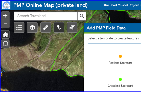
PMP have just launched a web based mapping application for use by farm advisors working on the Programme. The map has been developed by our Project Team using the ESRI @ArcGISOnline platform. Following farm visits, trained advisors will use the map to submit all data including score cards, supporting actions, and notable farm features. The secure map, that is accessed via any web browser on desktop or mobile devices, will streamline the process of submitting data needed to determine the result-based payment due to the farmer.
The information will also form the basis of the annual works plan. This plan will detail certain actions to be completed by the farmer with a view to improving their annual score and associated payment.
@EsriIreland @ArcGISOnline @Esri @agriculture_ie #EIPagri #pearlmusselproject #musselrivers